CATEGORIES:
BiologyChemistryConstructionCultureEcologyEconomyElectronicsFinanceGeographyHistoryInformaticsLawMathematicsMechanicsMedicineOtherPedagogyPhilosophyPhysicsPolicyPsychologySociologySportTourism
Parts of the world
3.10. North America
| NORTH AMERICA includes the countries of Canada, the United States, and Mexico, as well as the world’s largest island, Greenland. During the last Ice Age, a great sheet of ice flowed across the continent scouring the landscape, deepening the depressions that now hold the Great Lakes, and dumping fertile soil onto the central plains. | 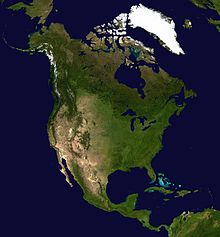
| |||||
| The Rocky Mountains form the backbone of the continent, running from Alaska to New Mexico. In the east are the Appalachian Mountains, flanked by coastal lowlands to the east and south. In eastern Canada lies the Canadian Shield, a huge basin of ancient eroded rocks now covered with thin soils. Deserts stretch from the southwestern United States down into northern Mexico. | ||||||
| | MOUNTAIN RANGES The main mountain ranges of North America, the snowcapped Rockies and the forested Appala-chians, vary greatly in appearance. | 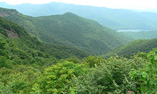 the Appalachians the Appalachians
| ||||
| The difference can be explained by their age. The Rockies are relatively young mountains that have not yet been worn down. The Appalachians, however, are among the world’s oldest mountains and have been gradually eroded by the scouring action of wind, water, and the movement of glaciers. | ||||||
| THE GRAND CANYON The Grand Canyon was formed over millions of years as the waters of the Colorado River and its tributaries carved their way through the solid rock. At some points the canyon is 1 mile (1.6 km) deep, and cuts through rocks that are 2,000 million years old. Different types of fossils found in the canyon walls reveal the dates of its changing history. | | |||||
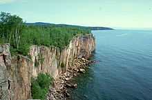
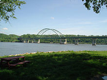
| THE GREAT LAKES Estimated to contain one-fifth of the world’s freshwater, the five Great Lakes straddle the border between Canada and the US. Only Lake Michigan, shown left, lies entirely within the US. The lakes are linked by waterways and drained by the St. Lawrence River, which empties into the Atlantic Ocean. The Niagara River, which joins lakes Erie and Ontario, passes over the famous Niagara Falls. | |||||

| ||||||
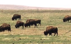
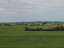
| THE GREAT PLAINS Across the center of Canada and the US lie the Great Plains, also called the prairies. This huge area has hot summers and cold, snowy winters. Trees are rare except along rivers and lakeshores, but the region was once covered with grasses grazed by millions of buffalo. Today, little natural prairie survives, and in its place farmers cultivate vast fields of corn and wheat. |
| |||||
| ||||||
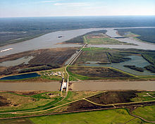
| THE MISSISSIPPI RIVER The great Mississippi flows from Minnesota to the Gulf of Mexico. At the turn of the last century, the destruction of forest and the plowing of prairies around the river basin caused severe soil erosion. Soil washed into the river, raised the water level, and caused floods. Replanting forests and building dams has helped control the flow, but exceptionally heavy rains still cause floods. | |||||
| ||||||
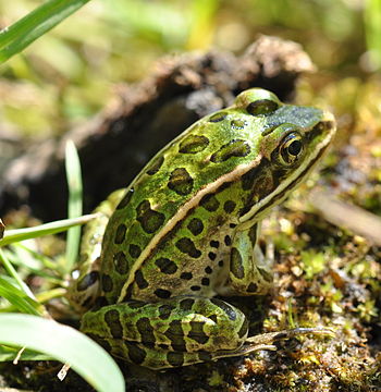
| THE EVERGLADES Florida’s Everglades are a protected wetland habitat, home to many rare plants and animals. Originally covering a much larger area, part of the Everglades has been drained and used for the cultivation of sugarcane. The northern part of the surviving wetland is now a sawgrass prairie, covered by shallow water with islands of higher land. In the south, freshwater mixes with water from the sea, creating salt marshes fringed by mangrove swamps. |
| |||||
| 
| |||||
Date: 2015-04-20; view: 1715
| <== previous page | | | next page ==> |
| TERRESTRIAL | | | CENTRAL AND SOUTH AMERICA |