CATEGORIES:
BiologyChemistryConstructionCultureEcologyEconomyElectronicsFinanceGeographyHistoryInformaticsLawMathematicsMechanicsMedicineOtherPedagogyPhilosophyPhysicsPolicyPsychologySociologySportTourism
THE EFFECTS OF THE WEATHER ON AVIATION
TEXT 1
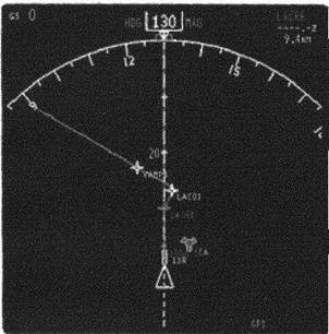
NAVIAGTION SYSTEM – AREA NAVIGATION
|
Computers in the aircraft can integrate
data from many navigational sources and
display a moving type map display of the
aircraft's location. These computers also
allow navigation away from the pre defined
centerlines provided by point source ground
based navigation aids. This concept is known
as Area Navigation (RNAV).
Increasingly flight in specified areas will
require aircraft to be area navigation
equipped. This allows the controllers to use
more flexible routing and to increase the
capacity of the airspace.
NAVIAGTION SYSTEM – VOR/DME
The VOR (VHF Omnidirectional Radio Range) used in association with the DME (Distance Measuring Equipment) provides a more accurate point source navigation system permitting accurate definition of air routes.
VOR enables a pilot to determine the direction to or from a VOR beacon and, if necessity, approach it on a preselected magnetic heading (QDM). The VOR is also widely used to define holding points and as a non-precision approach aid.
TEXT 2
NAVIAGTION SYSTEM – SATELLITE
Satellite systems are capable of providing very accurate three dimensional position information. In addition to the normal horizontal position information the height of the aircraft can also be determined. Accuracy can be of the order of one or two metres depending on the system and any ancillary equipment used.
Typical of the systems in use today are:
GPS- Global Positioning System (USA), aid
GLONASS - Global Orbiting Navigation Satellite System (CIS)
Together these from the GNSS - Global Navigation Satellite System.
For the moment both systems are managed by the military services of America and Russia. Discussions are under way to provide a civil controlled system. Currently the accuracy available is controlled by the military with their users receiving an accuracy around 12 m whilst civil users are restricted to an accuracy of 100 m.
The addition of a localised ground based satellite receiver that broadcasts correctional information can increase the civil accuracy to around 5 m. This is known as differential GPS.
The development of GNSS based ADS (Automatic Dependent Surveillance) will prove especially useful over sparsely populated and oceanic areas where radar (SSR) coverage is not possible. The position of the aircraft, determined by INS (Inertial Navigation Systems) and satellite systems, is relayed via satellite to a ground station where the signals are processed and can be presented to the controller on a synthetic dynamic display (SDD). Controllers have a virtual ‘radar’ picture of their traffic; Positional accuracy is in the order of 100m.
Satellite navigation will also soon provide sufficient accuracy to enable aircraft to carry out precision approaches and landings, thus reducing the need for ground based systems.
TEXT 3
THE EFFECTS OF THE WEATHER ON AVIATION
Except perhaps for local or very short flights, a pilot, before taking off, obtains a weather forecast giving him the weather conditions which are expected along the route of his flight and at his destination. Because weather conditions affect aircraft in flight, to a considerable extent, special aviation forecasts are provided by meteorologists at weather offices all over the world.
The meteorologist, or forecaster, prepares a weather chart which shows the current weather conditions over the whole country. The current weather chart is called a synoptic chart. This synoptic chart shows the areas of low pressure, the areas of high pressure, where precipitation is falling, and all other weather conditions across the country.
From this weather map, the forecaster can advise pilots of the weather conditions they can expect to encounter during their flights. A high pressure area, for instance usually means good weather while a low pressure area usually involves one or more fronts producing clouds and precipitation over many hundreds of miles.
A pilot needs to know the wind direction and speed. A headwind will obviously delay the arrival of flights and is to be avoided if at all possible. A tailwind on the other hand, can be of great advantage as it increases the ground speed and results in a reduction in fuel consumption. Winds vary with altitude, and also from one place to another, so information on winds is very important.
Pilots will pay particular attention to a low pressure area which lies en route, and the weather conditions associated with that low pressure area. The associated cold or warm fronts could involve clouds, thunderstorm, snow, rain, and turbulence. From his charts, the meteorologist can forecast where this weather will be at a certain time in the future, and with the help of these predictions, the pilot will decide which route to fly and when and he will know what weather conditions to expect. Should the forecast be very bad, for example, dense fog or poor visibility due to snow, the pilot may decide to postpone his flight. A pilot flying VFR would also cancel his flight because of low ceiling or low overcast conditions en route.
TEXT 4
Date: 2015-12-11; view: 1518
| <== previous page | | | next page ==> |
| Contemporary Russia: the fall and rise of the market economy | | | THE ROLE OF RADAR IN ATC |