CATEGORIES:
BiologyChemistryConstructionCultureEcologyEconomyElectronicsFinanceGeographyHistoryInformaticsLawMathematicsMechanicsMedicineOtherPedagogyPhilosophyPhysicsPolicyPsychologySociologySportTourism
Physiography and Topography
Physical Geography
As indicated in chapter 1, physical geography is divided into three basic areas of emphasis: geomorphology (landforms and physiography), climatology (climates and weather patterns), and biogeography (flora and fauna). Geomorphology is the branch of geography (and geology) that studies and explains how the geologic surface of the earth came to be the way that it is today. Much of this chapter focuses on the overall geomorphology of the US. Climate refers to the annual average pattern of weather in a region. This is discussed overall for the US in this chapter, though not as much as geomorphology. Biogeography, or the geographic distribution of plants and animals, is closely related to climatic patterns and is covered only minimally in this chapter.
Virtual Geomorphology*
Everything about geomorphology on a bilingual site in Poland.
Physiography and Topography
When most people speak of topography, they are actually referring to physiography. Topography refers to all of the surface features of an area. This includes the surface elevation, the vegetation, roads and buildings, and other features commonly found on topographic maps.Physiography is only the geologic surface or terrain features of an area. These are also known as landforms. Among the more common landforms are mountains, hills, valleys, cliffs, and plains. In addition, there are a wide variety of more specialized landforms that you will be introduced to in this book. The study of landforms is known as geomorphology. Geomorphology is studied by both geographers and geologists. It is that portion of geology that is of most interest to geographers because it helps to explain the physical environment which provides both the settings and the opportunities for human settlement.
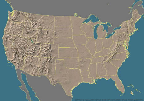
3-D Landform Image of the Conterminous US
The original URL for this image is: Color Landforms Atlas of the US* This site includes separate maps for each state.
Sedimentary, Igneous, and Metamorphic Rock*
The surface physiography of a region is shaped by its underlying rock structure. The three main types of rock are sedimentary, igneous, and metamorphic. Sedimentary rock consists of successive layers of wind or waterborne materials. Under pressure, these deposits turn into rock such as sandstone, shale, limestone and coal. Sedimentary rocks are the most common type found in the US.
Igneous rock originates deep within the surface of the earth. High temperatures in the center of the earth cause rock to melt. Molten magma "plutons" push their way up through the earth's crust. If the pluton solidifies before it reaches the earth's surface, it is known as an "intrusive igneous formation." A batholith is a massive intrusive feature. Batholiths exposed through the erosion of upper rock layers, such as California's Sierra Nevada Range, are usually composed of granite. Plutons that reach the surface of the earth extrude as lava.
Metamorphic rocks were once either sedimentary or igneous but have been changed through intense heat and pressure. This often happens where there is folding and crumpling of the earth's crust. Marble is a metamorphosed form of sedimentary limestone, while diamonds are a metamorphosed form of sedimentary coal.
Date: 2015-02-16; view: 6853
| <== previous page | | | next page ==> |
| PHYSICAL ACTIVITY | | | The Planet Earth and Continental Drift |