CATEGORIES:
BiologyChemistryConstructionCultureEcologyEconomyElectronicsFinanceGeographyHistoryInformaticsLawMathematicsMechanicsMedicineOtherPedagogyPhilosophyPhysicsPolicyPsychologySociologySportTourism
Perspectives and challenges of urban development in St. Petersburg
St. Petersburg - Transforming Industrial Heritage
Collaborative Urban Design Studio 2015-16
ENSA Strasbourg / ITMO St. Petersburg / KIT Karlsruhe
Background and general topic(s)
Perspectives and challenges of urban development in St. Petersburg
St. Petersburg is the second biggest Russian city with approx. 5 million inhabitants. The city is famous as the cultural capital of Russia with its unique historical monuments and museums. The whole central part of the city is protected as a UNESCO World Heritage Site, and there are numerous historical parks and gardens.
St. Petersburg is a city in transition. Since the dissolution of the Soviet Union and till today, the city is undergoing a period of significant changes. An important part of this transformation is the socio-economic and political-administrative reorganization after the socialist planned economy era. The processes of transition can be observed in recent developments of social and spatial structure oft he city – in and outside of the historical center.
Social change is leading to a polarization between a few new rich and a great poverty amongst the population. This social disintegration process led in recent years to a new dynamic in the housing market. First signs of social segregation can be identified in the spatial separation of social groups, in particular in some districts of downtown St. Petersburg which are increasingly turning into expensive, exclusive residential areas. Private housing developments and a growing suburbia with individual houses are the main sources for a spreading, unregulated and uncontrolled urban development. At the same time, a major problem is the supply of affordable housing.
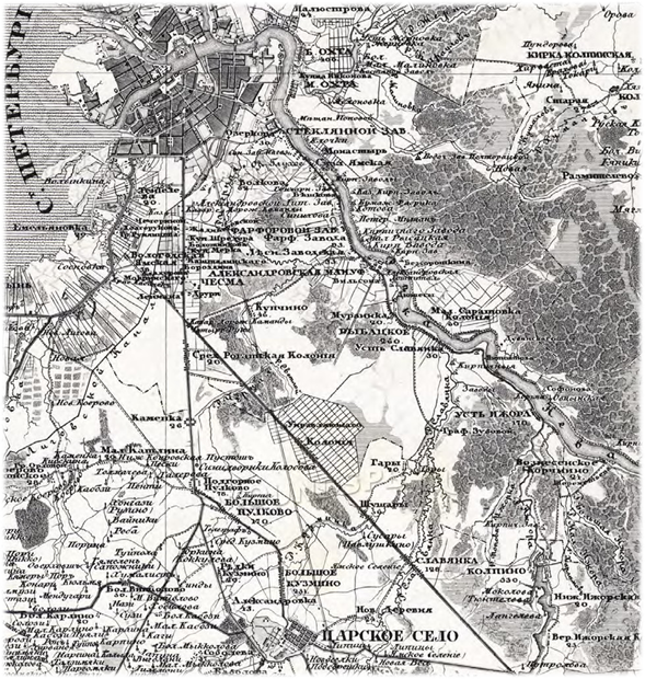
1: Map of St. Petersburg Province in 1840
Another evident change in the urban space is the tremendous growth of private cars in St. Petersburg since the 80s, resulting in incredible traffic problems. In the last 20 years motorization has increased 5 to 6 times, reached 300-350 cars per 1000 residents and is still rising. The transport infrastructure in the city is hopelessly overloaded. The inner-city traffic collapses almost daily. Another recent phenomenon is directly connected with the new economic situation. A lot of industrial factories in the central districts are closing and vacant areas are waiting for reuse. Little care is taken of ecological issues, preserving landscape and open space. A further problem is the treatment of historical buildings. Whilst the architectural conservation status of a UNESCO World Heritage Site of historic downtown is partially still critical, the change in the urban overall impression of a protected historical panorama remains a serious problem.
In 2005, a new General (Urban Development) Plan for St. Petersburg has been approved, focusing on issues such as housing, transformation and translocation of industrial areas as well as large infrastructure projects like the extension of metro lines, tunnels, highways and bridges. The Strategy 2030 is guiding the current discussion towards a socially balanced sustainable urban and economic development.
Today’s planning issues and challenges in St. Petersburg are manifold and complex – it will be important to control the considerable need for modernization in the domains of housing, infrastructure and economy for the benefit of the entire population of the city.
1.2. The Baltiskij train station and its neighborhood – the industrial belt
The site is located on the southern edge of the historical center, within the industrial belt, which surrounds the historic center with massive redbrick buildings having huge chimneys and water towers. This industrial landscape was mostly built between 1850 and 1910, during a period of an enormous growth of industrial and military technologies. St. Petersburg was then amongst the leading industrial cities in Europe. As a center for innovation and technical progress, the city was the basis for the entire industrial development of Russia and played an important role for the development of nearby countries. As the city grew, the industrial outer border which surrounded the central grandeur was gradually encircled by new urban districts. What was originally the city’s outer border became a central periphery. In this distinct belt, squeezed between the imperial center and the Soviet suburbs, the city's narrative blurs.

2: View on the industrial belt
Today, the area is characterized by diversity and fragmentation. Some parts are still in use, some have a less clear usage today, as a result of the economic recession that followed the collapse of the Soviet Union, which brought many of the former enterprises to bankruptcy. Other parts are still unused and in a stage of rapid decay. The importance of postindustrial territories in landscape and ecological regeneration is increasingly being recognized, as urban development is demanding additional areas for new functions. The former industrial territories serve as a reserve that can relieve pressure off the historic center and accelerate the process of urban space and landscape regeneration.
Situated between new expanded residential areas and historical center zones, many of those industrial territories are occupying very convenient positions close to transport infrastructure and parts of potentially attractive landscape, for example rivers and canals.
During the postindustrial period, the necessity for a major revision of the city’s policy on industrial zone redevelopment is becoming more evident. In order to improve the existing situation, the landscape of the “grey” belt, where old industrial buildings are for a long time surrounded by ecologically non balanced, aesthetically non attractive and functionally non effectively used open spaces, also becomes a subject for scientific research. The problem has recently become even more urgent, as new constructions are actively invading the historic center. Situated at a distance of 4 km from the Hermitage Museum and marked by a highly diversified urban fabric, the industrial belt offers a large potential to initiate a responsible and sustainable urban transformation process.
In the center of the area are located the Baltiysky station, mainly used for suburban traffic to the South, and the Varshavsky station (Warsaw station), a former passenger railway station, now serving as the Museum of Railway Machinery and a trade center. There are many barriers of transport lines (railway, roads) cutting the area off from its surroundings.
2. Collaborative Studio 2015-16: aims, task and program
Topics
The main task of the studio will be to work out a concept for urban development of the site. How to stimulate a process of transformation? Can existing buildings and constructions (and which ones) be converted for new purposes? How to transform the former mono-structured district into a vital neighborhood? Issues such as spatial connectivity and networks, new forms and organization of mixed-use building structures, natural/landscaped areas and public space will play a crucial role. What functions are needed? How to take into account economic pressure and ecological demands at the same time?
Spatial concepts for the handling of the existing buildings and urban fabric have to be developed. How can we qualify the relation to the adjacent areas? The urban layout shall include an idea for the built structures as well as for the landscape and open spaces.
In order to develop an urban transformation strategy and a spatial concept for the area, the following issues have to be taken into account:
City and water
Water is an essential part of the origin and identity of St. Petersburg. The changing relationships between the build areas and the water had been an important factor in the evolution of the urban forms, depending on their functions (industrial, administration, housing...) and the historic periods. While industrialization often implicates the pollution of water, having as the result the turning away of the city from the waterfronts, the currently ongoing transformation of industrial areas and the purifications of the water, leads to the revival of waterfronts. Relationship between the city and its waterfronts, canals and rivers has to be reconsidered – there is a lot of potential to use the water as “asset”, for “place-making” or creating a unique address.
Date: 2016-01-14; view: 1157
| <== previous page | | | next page ==> |
| Analog signallarynyň diskretleşdirilmegi | | | Mixed areas and proximity |