CATEGORIES:
BiologyChemistryConstructionCultureEcologyEconomyElectronicsFinanceGeographyHistoryInformaticsLawMathematicsMechanicsMedicineOtherPedagogyPhilosophyPhysicsPolicyPsychologySociologySportTourism
Geography
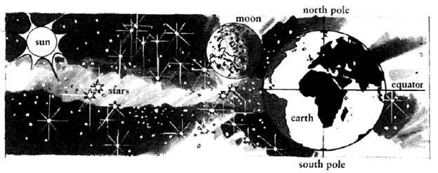
Physical features
Note: Sometimes you need the definite article 'the', e.g. The Atlantic Ocean, The Alps;
Natural disasters
A disaster is when something terrible happens, which often results in death, destruction and
Exercises
1. Complete these sentences, as in the example.
Example: The Nile is a river
2. Answer some geography questions.
1. Where is Argentina? 2. What is the name of the mountain range in the west of North America? 3. What is the name of the sea between Africa and Europe? 4. What is the name of the ocean between America and Asia? 5. What is the name of the ocean between Africa and Australia? 6. Of which country is Washington the capital?
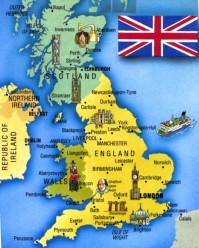
Geography Look at the map. You can see that the United Kingdom of Great Britain and Northern Ireland is situated on the Isles. They are called the British Isles. There are more than 5000 small islands there. Two of them are the biggest: Great Britain and Ireland. We know that the UK consists of 4 countries: England, Wales, Scotland and Northern Ireland. England, Scotland and Northern Ireland are situated on the largest island which is called Great Britain. Northern Ireland is situated on the smaller one which is called Ireland and occupies the northern part of it.
You can see that the UK is washed by water from all sides. It is separated from Europe by the English Channel and the Strait of Dover. It is washed by the Atlantic ocean in the west, by the North sea in the east. The UK is separated from the Ireland by the Irish sea. The geographical position flavoured the development of the country as a great sea country. England occupies the southern part of Great Britain. Scotland is in the north of the island and Wales is in the west of Great Britain and Northern Ireland is in the north-east of Ireland. The central and the most beautiful part of the county is England. The landscape is diverse. In the north and in the west of the country you can see mountains, but the other area is plain. England has more fertile soil than others. Also there are many lakes in the north-western district which is known as Lake District. Scotland can be called the country of mountains. The region of the mountains which is known as Highlands is the oldest in the world. The Grampians is the chain of the mountains there. Ben Nevis is the highest peak. There are some other chains: the Pennine in England and the Cumbrian Mountains in Wales. You will find a lot of forests along the county. But none of them can be called great. The biggest one is Sherwood Forest. It occupies the area in the eastern part of England. Of course, you have heard the legends about it. The most famous is about Robin Hood. There are many rivers in the UK. But they are not long. The longest one is the Severn which flows in England. The Thames, the Mersey and the Clyde are the most important rivers. They play a great role in British trade and commerce. You can travel by water along the whole country because many of the rivers are connected14 by canals. London, Glasgow, Liverpool,Birmingham, Manchester and Edinburgh are the largeast cities in the UK. The total area15 of the UK is 224,000 sq km. And the population16 is about 60 million. Its advantageous17 position has made the UK one of the powerful country in the world.
Date: 2015-01-02; view: 2319
|