CATEGORIES:
BiologyChemistryConstructionCultureEcologyEconomyElectronicsFinanceGeographyHistoryInformaticsLawMathematicsMechanicsMedicineOtherPedagogyPhilosophyPhysicsPolicyPsychologySociologySportTourism
Oceanographic regime 2 page
pole of warmth was observed.
Thus, the so-called feeding current is the single source of cold water in deep- water regions of the sea. The renewal of water there takes place in winter because in summer the Gorlo water is strongly heated and mixed with fresh/low-salinity waters. From the long time series of hydro-physical data on water temperature and salinity, some basic features of their seasonal and long-term (multi-year) variability have been established. The distribution of the mean seasonal sea surface water
temperature has been determined (Figure 4.6).
Three water masses residing in the White Sea can be distinguished in winter: Barents Sea, Gorlo, and Voronka water masses. The Barents Sea water occupies the entire western half of the Voronka. A portion of the Barents Sea water, having been transformed in the bottom layers, does not turn northwards, but, following the

Figure 4.6. Spatial distribution of water surface temperature fields across the White Sea in different seasons: (a) spring, (b) summer, (c) autumn.
From White Sea (1991).
|
 Figure 4.7. Distribution of water masses across the White Sea during spring. (1) Voronka, (2) Barents Sea, (3) Gorlo, (4) Bassein, (5) intermediate, (6) deep, (7) bay freshened, and (8) slightly transformed river.
From White Sea (1991).
bottom depressions along the Terskiy coast, flows southward in the form of a
feeding current (the Deriugin Current), which can be observed over the entire length of the Gorlo. Formed by the incoming Barents Sea water as well as by water arriving from other sources, the water mass in the Gorlo is then transformed, due to strong mixing, into a practically homogeneous one. During spring, eight water masses can be ascertained in the White Sea. During this period, when the river runoff becomes significantly higher, riverine waters are predominant in the hydrological structure of the sea (Figure 4.7).
A considerable summertime heating of water enhances the water column strati- fication and augments the gradients in the thermocline. Six water masses can be identified for the summer period: surface water of the Barents Sea, Gorlo and Bassein, as well as intermediate water, deep water and, finally, freshened bay water. The vertical structure of the Bassein water is as follows: surface water extends from the surface to a depth of 20 m. Lower, they are followed by a transitory layer about 20 m thick. Between the depths of 40 and 60 m, an intermediate water mass is located. Further down, a transitory zone extends to 100 m in depth. Below 100 m, deep-water masses are found (Figure 4.8).
Mixing processes significantly affect the formation of water masses. In particu- lar, ebb and tidal mixing forms a homogeneous vertical structure of the Gorlo waters. The wind and convective mixing control the vertical extension of surface waters.
According to the long-term data available, annually, the river runoff brings to the White Sea about 231 km3of fresh/desalinated water. Approximately the same

 Figure 4.8. A vertical profile of water temperature distribution along the Voronka-Gridino transect.
amount of transformed water must flow out of the sea. In the aforementioned calculations, the seasonal variability of the mean sea surface level has not been taken into account. In the water balance of the sea, the main portion arises from the river runoff, which accounts for 95% of freshwater incoming to the sea (Elisov, 1985, 1997; Bryzgalo and Ivanov, 2000).
The annual evaporation from the surface and atmospheric precipitation are practically mutually compensatory. Within a year, the water balance of the sea is positive (i.e., the river runoff (even during the winter period of low water) prevails over evaporation). The water exchange between the White and Barents Seas varies seasonally, which is determined, as it has been mentioned above, by river runoff. The springtime high water in May-June accounts for about 50% of the annual discharge of river water into the sea; the water exchange between the two seas increases correspondingly. The annual river runoff entering the sea (Table 4.2) corresponds to an effective water layer of about 2.6 m, whereas the precipitation and evaporation correspond to the effective layers of about 37 cm and 24 cm, respectively.
Seasonal variations of the mean level of the White Sea do not exceed several centimeters, which is within the limits of the accuracy of determining the water runoff layer (Inzhebeikin, 2001). Table 4.2 has been compiled according to the results of Elisov (1997). It should be emphasized here that the data on river runoff displayed in Table 4.2 are not strictly consistent with the respective data given in some of the following tables reported by other researchers. This inconsistency, although generally rather insignificant, is due to the fact that different authors
Table 4.2. Mean monthly and annual freshwater inflow (in km3) into the White Sea according to the long-term observations by Elisov (2000).

Months

 Jan Feb Mar Apr May Jun Jul Aug Sep Oct Nov Dec Annual 6.6 6.2 6.6 13.8 70.8 39.9 21.6 16.2 16.0 19.5 13.9 8.3 239.3
|
used different periods of averaging as well different concrete years over which the averaging has been actually performed.
Taking into account the complicated nature of water currents and the presence of tides, the volume of water exchange between the White and Barents Seas is about 2,200 km3(Hydrometeorology and Hydrochemistry .. ., 1993).
Therefore, given the White Sea water volume is about 6,000 km3, the time of renewal of the White Sea water may be about three years. Nevertheless, Elisov (1985) shows that, due to non-periodic currents, about 4,000 km3of water flows out of the White Sea, whereas only 3,500 km3of water flows in; thus, it may be concluded that the complete water renewal can take about 1.5 years. Based on extensive observa-
tions of biological variables, it has been shown that the zooplankton species indi- genous to the Barents Sea are almost absent in the White Sea. This implicitly points to a limited-scale penetration of the Barents Sea waters into the White Sea.
The water exchange between the seas can be assessed more accurately from numerical modeling results. Semyonov (1999) and Elisov (1997) showed that freshened water leaving the Gorlo turn northwards and approach the Terskiy coast, thus hampering the inflow of the Barents Sea water masses. Chapter 10 expands on the specific features of the processes controlling the water exchange between the two neighboring seas, based on numerical modeling data.
A wealth of long-term investigations of heat and mass exchange (Elisov, 1997) indicates that during the autumnal period of cooling, the water mixing becomes more intense. In addition, an increase in the thickness of the upper quasi-homo- geneous layer is observed, and the water temperature in the Bassein and Gorlo becomes spatially homogeneous. When the river runoff decreases and the wind circulation is enhanced, warmer waters from the Barents Sea flow into the Bassein. During the winter period, the most intensive inflow of salts from the Barents to the White Sea takes place. During spring and summer, the seawater salinity decreases. The water salinity grows in the low-water period, the greatest salinity increase being observed in the northern parts of the White Sea (the Voronka and Gorlo regions as well as Mezenskiy Bay). About 60% of the salts enter the White Sea during the wintertime.
In the Bassein, in the layers located 50-100 m over the bottom, the water temperature varies only slightly throughout a year and is about -1.4oC (Kuznetsov, 1960). The annual mean temperature of the surface layer in the Voronka is 4.2oC, while in the Gorlo, Bassein, middle part of Onezhskiy Bay, and Kandalakshskiy Bay it is 2.2oC, 3.5oC, 3.2oC, and 4.0oC, respectively. In winter, the surface water temperature in the Bassein, Gorlo, and Voronka varies between -1.7 and -1.2oC; in the bays its variation range is less (-0.7 and -0.5oC), although the water temperature values per se are higher. During spring, the water temperature rises on average by 2oC in the Voronka and Gorlo, by 4oC in the Bassein, and by 6oC in the bays.
During summer, in the Bassein and bays, the surface layer waters are heated appreciably. In August, the surface water temperature is about 14-16oC. In October, the coastal zone waters loose their temperature very fast: indeed, it becomes lower than that in the open parts of the White Sea. The coastal waters as a whole, in
Table 4.3. Main characteristics of the mean annual water surface temperature in the White Sea as measured at the Solovki, Gridino, Zhuzhmuy, Intsy, Kandalaksha, and Chavanga stations.

Station

 Solovki Gridino Zhuzhmuy Intsy Kandalaksha Chavanga
Annual mean water 3.68 3.69 3.40 3.04 3.87 3.53
temperature (oC)
Mean-square deviation 0.33 0.33 0.45 0.49 0.34 0.35
| Dispersion | 0.11 | 0.11 0.20 | 0.24 | 0.12 | 0.12 |
| Interval (oC) | 1.37 | 1.36 1.83 | 2.29 | 1.22 | 1.41 |
| Minimum (oC) | 3.14 | 3.15 2.62 | 2.29 | 3.37 | 3.08 |
| Maximum (oC) | 4.51 | 4.51 4.45 | 4.58 | 4.59 | 4.49 |
comparison with pelagic waters, are characterized by a higher temperature in summer and a lower one not only during autumn but also in winter (due to the winter water desalination mechanism), although in spring the water temperature there is higher. Mean monthly surface water temperatures vary in the Voronka from 0.1 to 10.1oC, in the Gorlo from -1.7 to 8.4oC, in the Bassein from -0.4 to 10.6oC, in Onezhskiy Bay from -1.7 to 11.9oC, in the Dvinskiy and Mezenskiy Bays from -0.5 to 13oC, and in Kandalakshkiy Bay from -0.4 to 14.4oC (Table 4.3) (Kuznetsov, 1960; Oceanographic Conditions .. ., 1991).
A highly complicated system of water circulation patterns, large amounts of fresh river water discharging into the sea, and strong tides collectively determine the formation of an intricate density regime and ensuing frontal zones. One of the consequences of tidal mixing is the presence in the White Sea of two types of vertical profiles of water temperature and salinity.
The first type occurs in the Bassein and deep-water parts of Kandalakshskiy Bay (Figure 4.9). Its specific features, especially in summer, are: well pronounced water stratification, presence of an upper layer and seasonal thermocline, as well as water temperature vertical gradients reaching 1.5oC m-1. Below the thermocline, in the layer located 50-60 m above the bottom, the water temperature is vertically homo- geneous remaining in the range 1.5-1.6oC. The annual amplitude of water tempera- ture variations in the upper layer is 12-15oC.
The second type of temperature distribution can be found in the Gorlo, Voronka, and Onezskiy and Mezenskiy Bays. It is characterized by a monotonous temperature decrease with depth, and sometimes by a nearly complete thermal homogeneity. K.M. Deriugin suggested the following the names for those two types: the Bassein-type and the Gorlo-type , respectively (Figure 4.10).
We have only limited knowledge about the hydrological regime of the open part of the White Sea during winter. In this season, a considerable part of the sea is covered with drifting ice. Earlier than anywhere else (at the end of October) the first ice appears in the mouth of the Mezenskiy River, and later than anywhere
|
 |
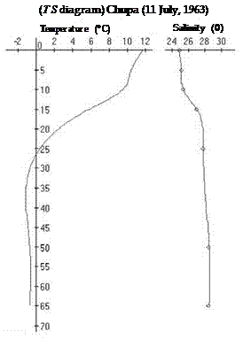 Figure 4.9. Typical stratified vertical distribution of both water temperature and salinity in Kandalakshskiy Bay during summer.
else (in January) near Terskiy, as well as in the Voronka and Gorlo. As a rule, floating ice is 30-70 cm thick, but in severe winters it can be as thick as 150 cm. Fast ice in the sea occupies a small area, and, except for Kandalakshskiy Bay, its width rarely exceeds 3-5km. In the Voronka, the ice cover disappears the earliest (at the end of March). By the end of May, the entire White Sea is ice-free. On the sea surface and practically down to the bottom, the water temperature everywhere (except for the cape Sviatoy Nos region) is close to freezing point. In the western part of the Bassein, at depths of about 50-100 m, layers with higher temperatures (up to 1.5oC) have been found in a number of cases.
In winter, the water salinity is higher everywhere than during summer. Salinity registered in surface water was 29-300 in the Voronka and Gorlo and 27-280 in the Bassein. Water in estuary regions of the bays in the White Sea are most freshened. As a rule, the surface salinity remains intact down to 30-50 m, below which the salinity increases smoothly towards the bottom.
During the springtime, the White Sea receives large amounts of relatively warm freshwater. This is a period of intensive sea ice melting and heating of upper layers of the sea by solar radiation: indeed, up to 70% of the annual influx of solar radiation
 Temperature(oC) Salinity (0)

Figure 4.10. Typical mixed distribution of both water temperature and salinity in the shallow part of Onegskiy Bay during summer.
arrives during this period. The mean wind velocity in May-June does not exceed 5- 6m s-1.
4.4 FRONTS AND FRONTAL ZONES
Marine frontal zones differ in their mechanisms of generation and their physical nature. Some are formed under the influence of river runoff (the runoff and estuarine fronts), whereas others are due to tides and seasonal heating, to specific features of the bottom and shores (the tidal and shelf fronts). Despite these differ- ences, they have much in common. All the above-mentioned types of fronts are observed in the White Sea (Elisov, 1997). The characteristics of the various White Sea fronts and frontal zones are described in the following sub-sections.
4.4.1 River runoff fronts
River runoff (or plume) fronts are the boundaries between the freshwater of rivers flowing into the sea and the seawater proper. Plumes in the sea are extended strips
|
about 5-15 km wide. The heat and freshwater runoffs originate plume fronts, which start from the marine part of the deltas extended along the right-hand bay coast and distinctly observed during the entire ice-free period. The salinity of runoff water is always lower than that of marine water. All three large rivers discharging into the White Sea come from the south, and their estuarine coastal waters are warmer in May-September than the adjacent marine waters. In October, the temperature of runoff water becomes lower than that of the open seawater, and in early November it is close to freezing point - ice cover begins to form in the river estuaries.
Runoff fronts are formed under the influence of water brought by the Severnaya Dvina, Onega, and Mezen Rivers, and the rivers flowing into the Kandalakshskiy and Onezhskiy Bays. These fronts appear when river water does not mix completely with seawater in the estuary, thereby forming a comparatively thin layer of fresh or brackish water on the surface. In places where sea and river water comes into contact, sharp horizontal salinity gradients appear. Directly under the lens of fresh- water, a compression shock originates, considerably hindering water mixing at depth.
The runoff fronts are mainly registered according to their salinity gradients. For instance, in Dvinskiy Bay in some years the water salinity gradients reach several 0 per kilometer. In spring, water salinity gradients within runoff fronts constitute, on average, 0.13-0.370 km-1.
Apart from water salinity gradients, water temperature gradients are also observed in runoff fronts because in spring, river water is warmer than seawater; on average, the gradients are 0.08-0.17oC km-1. When the summer warming begins, the temperatures of river and seawater become about equal, and the runoff fronts turn into purely salinity fronts.
The specific features of fronts and frontal zones in the White Sea will now be described in more detail. In the vicinity of Cape Zimnegorsky, the runoff front is interlocked with the tidal one. The density stratification is so distinct that the plume with lower water salinity and higher temperature can be observed up to the boundary demarcating the Gorlo and Voronka regions.
The runoff front is notably well pronounced in late May-early-June, when the waters of the Severnaya Dvina River can be easily discerned even in the Voronka. From Cape Voronov, the waters turn to the Tersky coast, approximately near Cape Gorodetsky they move off the coast to the east, and near Cape Kanin Nos stream to the Barents Sea. The runoff front is located between the waters of the Bassein and the transformed waters of the Severnaya Dvina River, where water salinity does not exceed 12-140 (in some cases 7-80) and the temperature is 5-6oC. Frequently at the end of May the water temperature on the surface was 10-13oC, and at a depth of 10 m it was negative. In spring, the spatial location of fronts, especially in the early stages of their formation, is rather unstable, and the thickness of the warmed layer is about 5m. At the beginning of June, in calm conditions, the temperature gradient over the front line may reach 10-12oC. Wind intensification leads to a rapid drop in surface water temperature both in the Basin, and runoff waters. It is also conducive to the destruction of frontal divides. The location of river water propagation bound- aries in the sea is shown in Figure 4.11.
 Figure 4.11. Seasonal location of the boundaries of river plumes: 1- spring, 2 - summer, and 3 - autumn.
From Berger et al. (2001).
4.4.2 Tidal fronts
Tidal fronts are due to an inhomogeneous distribution of speeds of ebb and tidal currents across the sea surface. The location of the basic frontal zones in the sea is shown in Figure 4.12.
The tidal fronts should be considered as the basic fronts in the White Sea. The first tidal front is located along the Cape Nikodimsky-Cape Veprevsky transect, and the second one lies 5 to 10 miles northwards off the Solovkiy Archipelago (Figure 4.12). These fronts separate two main water masses in the White Sea. These are water masses with different types of vertical distribution of hydrological parameters. The formation of tidal fronts begins in the middle of May, after ice cover melts. In the Gorlo, during springtime two stable (steady) frontal delineations are observed. The tidal front separates the waters of the Bassein with a surface tempera- ture of 2-3oC (the 0oC isotherm is at the depth of only 5-8 m) from the cold, homogeneous water at depth in the Gorlo with a temperature of about 0oC. In late July-early August the tidal fronts are most pronounced. The division takes place along the 40-50 m isobath, and its width does not exceed 8-10 km with hori- zontal gradients of the order of 1oC km-1. The water salinity in the mixed waters of the Gorlo is about 10 in spring and 1.5-20 in summer, and it is higher than in the Bassein. During this period, the water temperature decreases steeply (4-5oC) across
|
 Figure 4.12. Monthly variations (from May to November) of the location of the tidal front in the White Sea.
Semenov and Luneva (1999).
the front in the vicinity of the Solovki Salmas settlement. The frontal zone there is wider than in the Gorlo (10-15km) and goes along the 50-80-m isobath. The hori- zontal temperature gradients do not exceed 0.2-0.4oC km-1. In contrast to the Gorlo, the front in Onega Bay separates the stratified waters of the Bassein from the mixed waters of Onega Bay, the warmest ones in the entire White Sea.
A characteristic feature of tidal fronts is the change of sign of the horizontal water temperature gradient with depth. In summer, in the Bassein, at a 30 m depth and deeper, the water temperature does not exceed 0oC; in the mixed waters the entire water column temperature is 7-8oC. Spatial variations in the frontal zone width during the tidal cycle are large and determined by the tidal current speed.
4.4.3 Upwelling fronts
The upwelling front is formed due to the ascension of deep cold water to the surface. Upwelling fronts are often observed in the region of the Solovkiy Archipelago. These are considered in detail in Chapter 6, based on the analysis of remote sensing data.
4.4.4 The front between the White and Barents Sea waters
Fronts of this type of can be clearly observed throughout a year, although in this case the water temperature and salinity variations are not as pronounced as they are in tidal and river plume fronts. The salinity in the Barents Sea is always higher than in the White Sea, and the water temperature there is lower from May to October and higher from October to April. Thus, during the warm period, the Bassein is actually isolated by frontal zones from the Gorlo and the Dvinskiy and Onezhskiy Bays.
With regard to Kandalakshskiy Bay, which is adjacent to the Bassein on the north- western side, no large rivers flow into it and the tidal currents are not particularly strong (10-30 cm s-1). Therefore, there are no conditions for generating frontal zones there.
During the tidal cycle, the frontal zone between stratified and mixed water is subject to variations, their amplitude being proportional to the tidal speed. During the quadrature, the amplitude decreases by a factor of 1.5-1.7 in comparison with the syzygy (i.e., opposition) period. A short-term wind strengthening during sum- mertime is not consequential to the front location. In October, the water surface temperature becomes homogeneous, and fronts can be revealed only from the data of deep-water measurements.
As a result, the water masses of the White Sea differ from those of the Barents Sea. The Barents Sea (feeding) current, incoming to the sea along the Tersky shore, passes through Gorlo and flows to the Kandalakshskiy Bay along the northern coast of the Bassein. Having passed through Kandalakshskiy, Onezhskiy, and Dvinskiy Bays and having transformed notably owing to their mixing with the river runoff, these waters move again to the Gorlo and form the White Sea (runoff) current, with the characteristics significantly differing from those of the initial Barents Sea water (see Figure 4.2). Surveys of thermal fronts made from an aircraft in the 1980s have revealed that the amplitude of the front location variations in space is 5-8 km and depends upon the size of the tide - during the syzygy the amplitude is approximately 1.5 times greater than during the quadrature period.
With the horizontal temperature gradient in the frontal zone of about 0.5oC, the water temperature variability within the tidal cycle amounts to at least 2.5 to 4.0oC. In stratified regions, the variability of water temperature during the tidal cycle is rather low and does not exceed 0.1 to 0.3oC (Elisov, 1997). The effect of synoptic wind perturbations does not lead to any noticeable change in the position of the front.
4.4.5 Features of marginal filters (barrier zones) in the bays of the White Sea
The White Sea has zones where dramatic transformations of dissolved and suspended water constituents occur (Lisytsyn et al., 2000). These are the so-called barrier zones, or marginal filters, which remove more than 90% of suspended water constituents and about 40% of dissolved substances (Lisytsyn, 1994). In estuaries, the marginal filter area is limited by the frontal zone and is characterized by rela- tively high gradients of physical and chemical parameters, which are readily revealed through water temperature and/or salinity gradients. These zones are characteristic of mixed fresh river water and saline seawater. The aforementioned transformations of dissolved and suspended matter takes place there, and lead, in the long run, to the so-called barrier effects. These are multi-step filters, consisting of a number of consecutive processes, involving gravitational sedimentation, as well as physico- chemical and biological reactions. Understandably, the existence of such zones with barrier effects reduces substantially the anthropogenic impact upon the marine environments.
|
The White Sea is characterized by a high geochemical and low biochemical activity of the ecosystem. For example, the annual input of nutrients accounts for more than a half of their content in the sea (Maksimova, 1978).
Mixing of river and marine water in the White Sea results in a spatially non- uniform growth of water salinity. In the area of interaction of river and seawater within the coastal zone, three sub-zones can clearly be distinguished (Dolotov et al., 2002). The first sub-zone is a freshwater, or internal (transitional) area, where the degree of water mineralization varies insignificantly. The second sub-zone is an area of mixing, characterized by the highest horizontal and vertical water salinity gradients (the hydrologic front is located within this sub-zone). Finally, the third sub-zone (also called the external sub-zone) is an essentially marine area.
The zone of mixing of fresh (river runoff) and saline (marine) water is an active barrier for chemical elements with variable valence. The maximum amount of suspended matter, which generally carries on its surface a wealth of absorbed mineral components, settles to the bottom. The dissolved substances coagulate and fall out as sediments (Skibinsky, 2001). The highest concentrations of suspended matter in the surface layer (0.64-1.8 mg l-1) have been found in the Gorlo. However, as they diminish closer to Kandalakshskiy Bay, the content of suspended matter is much less, constituting 0.35-1.13 mg l-1. In the vertical distribu- tion of suspended matter, a higher concentration is restricted to surface waters (0-5m) and typically it is significantly lower at depth, notably, below the pycnocline. Within the river-sea boundary, in the zone of mixing of water of the inflowing rivers and waters of Kandalakshskiy Bay, the suspended matter concentration is nearly immune to the increase of water salinity from 0 to 200. More than that, it even slightly increases in the area of inflow of the Kolvitsa River. The main cause of such an unusual distribution of suspended matter at the river-sea boundary is a low concentration of suspended matter in rivers flowing into the White Sea from the
Karelskiy coast and the Kola Peninsula (Shevchenko et al., 2002).
Date: 2016-03-03; view: 722
| <== previous page | | | next page ==> |
| Oceanographic regime 1 page | | | Oceanographic regime 3 page |