CATEGORIES:
BiologyChemistryConstructionCultureEcologyEconomyElectronicsFinanceGeographyHistoryInformaticsLawMathematicsMechanicsMedicineOtherPedagogyPhilosophyPhysicsPolicyPsychologySociologySportTourism
World maps
About our world
Our world is the planet Earth. It is one of 9 planets which circle around the sun. The earth is shaped like a ball, which is slightly flattened at the top and bottom. Most of the earth, about 70 %, is covered by sea and the rest is land. The land on earth is in seven main patches, which are called continents. Imagine holding a small model of the earth in your hands. If you turned it round you would be able to see the continents, as in the pictures below.
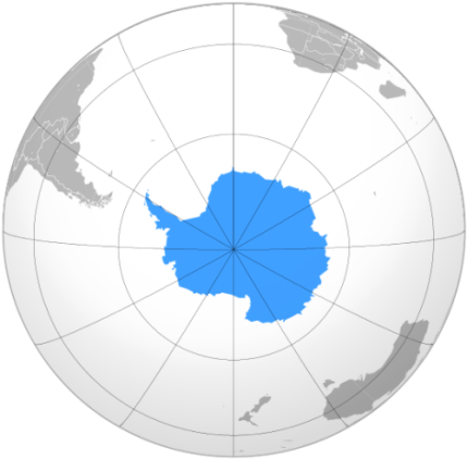 Antarctica
| 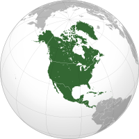 North America
| 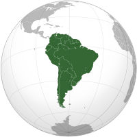 South America
|
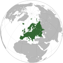 Europe
| ||
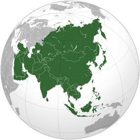 Asia
Asia
| 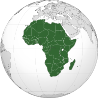 Africa
| 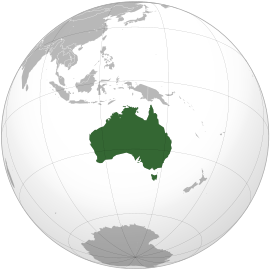 Australia
|
World maps
A world map is a map of the surface of the Earth, which may be made using any of a number of different map projections. A map projection is any method of representing the surface of a sphere or other three-dimensional body on a plane.
World maps form a distinctive category of maps due to the problem of projection. Maps by necessity distort the presentation of the earth’s surface. Distortions reach extremes in a world map. The many ways of projecting the earth reflect diverse technical and æsthetic goals for world maps.
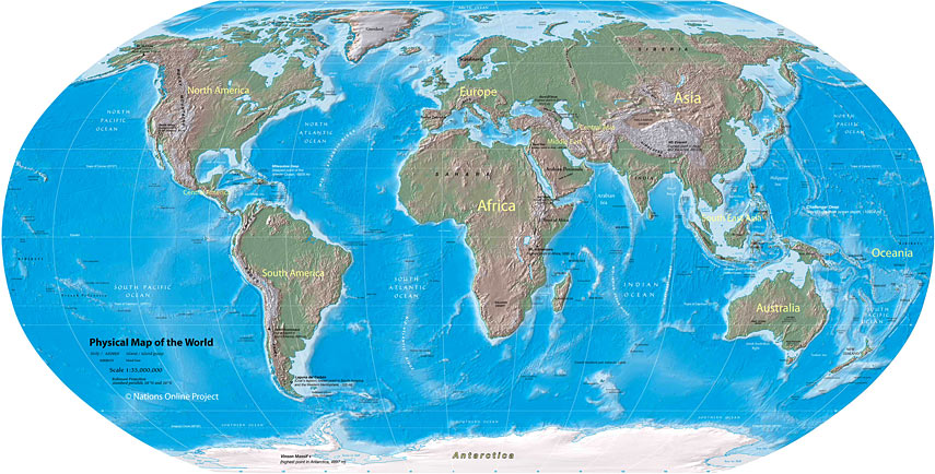
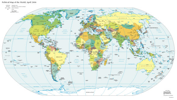
Maps of the world generally focus either on “political” features or on “physical” features. Political maps emphasize territorial boundaries and human settlement. Physical maps show geographic features such as mountains, soil type or land use. Geological maps show not only the surface, but characteristics of the underlying rock, fault lines, and subsurface structures.
|
This map of the world shows where the world’s main mountains, plateaus, plains, oceans, rivers and lakes are. You can see from this map that there are mountain ranges in the sea as well as on the land. The deepest parts of the sea are long, narrow trenches.
|
Such a map shows the positions of all the countries of the world. Some of the countries are so small that the names do not fit. These countries are numbered. You can look up the numbers, to see which countries they are, in the lists around the map.
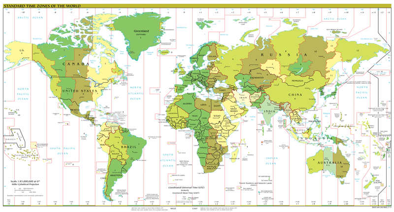
A time zone is a region on Earth that has a uniform standard time for legal, commercial, and social purposes. It is convenient for areas in close commercial or other communication to keep the same time, so time zones tend to follow the boundaries of countries and their subdivisions. Time zones are often represented on Time Zones Maps:
|
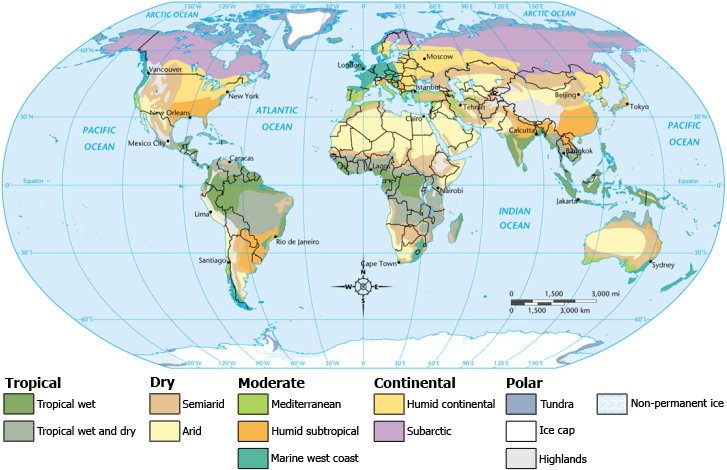
The kind of plants and animals around the world depend on what sort of climate the area has – how hot, cold, wet or dry it is. They are also affected by the kind of soil, whether the land is flat or hilly and by farming and towns. Together these things make up areas called environments, where particular kinds of plants and animals live.
The five main latitude regions of the Earth’s surface comprise geographical zones, divided by the major circles of latitude. The differences between them relate to climate, and the behaviour of the Sun. They are as follows:
· The North Frigid Zone, north of the Arctic Circle
· The North Temperate Zone, between the Arctic Circle and the Tropic of Cancer
· The Torrid Zone, between the Tropical Circles
· The South Temperate Zone, between the Tropic of Capricorn and the Antarctic Circle
· The South Frigid Zone, south of the Antarctic Circle
·
|
Torrid Zone: In the Torrid Zone, also known as the Tropics, the Sun is directly overhead at least once during the year. In the Northern Hemisphere, the overhead Sun moves north from the Equator until it reaches 23.5 degrees North (Tropic of Cancer) at the June solstice, after which it moves back south to the Equator. In the Southern Hemisphere, the overhead Sun moves south from the Equator until reaches 23.5 degrees South (Tropic of Capricorn) at the December solstice, after which it moves back north to the Equator.
Temperate Zones: In the two Temperate Zones, consisting of the tepid latitudes, the Sun is never directly overhead, and the climate is mild, generally ranging from warm to cool. The four annual seasons, Spring, Summer, Autumn and Winter, occur in these areas. The North Temperate Zone includes Great Britain, Europe, northern Asia, North America and northern Mexico. The South Temperate Zone includes southern Australia, New Zealand, southern South America and Southern Africa.
Frigid Zones: The two Frigid Zones, or polar regions, experience the midnight sun and the polar night for part of the year – at the edge of the zone there is one day at the winter solstice when the Sun does not rise or set for 24 hours, while in the centre of the zone (the pole), the day is literally one year long, with six months of daylight and six months of night. The Frigid Zones are the coldest parts of the earth, and are generally covered with ice and snow.
Date: 2015-04-20; view: 5241
| <== previous page | | | next page ==> |
| PART THREE | | | MAPPING THE OCEANS |